Magandang Araw!
Welcome to Antipolo City, Rizal

-Antipolo, officially the City of Antipolo (Tagalog: Lungsod ng Antipolo), is a 1st class component city and capital of the province of Rizal, Philippines. According to the 2015 census, it has a population of 776,386 people. It is the most populous city in the Calabarzon region, and the seventh most-populous city in the Philippines.
-Antipolo was converted from a municipality into a component city of Rizal Province on April 4, 1998, under Republic Act No. 8508. A new provincial capitol building was inaugurated in the city in March 2009 to replace the old capitol in Pasig, which has long been outside the jurisdiction of Rizal Province, since Pasig was included in Metro Manila in 1975. With the transfer of the provincial government to Antipolo, it is highly favored to be officially designated as the new capital of the province. On March 14, 2011, Antipolo was declared according to Proclamation No. 124 s. 2011 a highly-urbanized city by then-President Benigno Aquino III; however, the proclamation has yet to be ratified in a plebiscite. Pending a plebiscite, Antipolo is the most populated city in the Philippines under a component city status. On June 19, 2020, President Rodrigo Duterte signed Republic Act 11475, designating Antipolo City as the official capital of Rizal Province. It took effect on July 7, 2020.
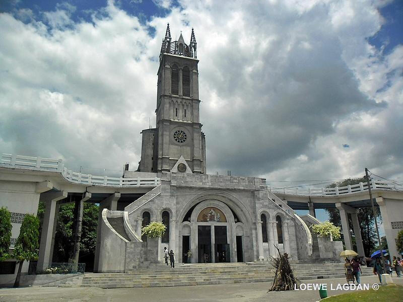
-The city is popular for being a pilgrimage site. It prides itself as the "Pilgrimage Capital of the Philippines". The Marian image of the Our Lady of Peace and Good Voyage or the Virgin of Antipolo, which was brought in from Mexico in 1626, and enshrined in the Antipolo Cathedral has a continuous following among Filipino Catholics since the Spanish colonial era. A popular custom of pilgrimages to the Virgin of Antipolo is the trek going to its shrine on the eves of Good Friday and May 1, from various locations in Rizal Province and Metro Manila. The most notable of these pilgrimages would begin the trek from the Minor Basilica of the Black Nazarene (Quiapo Church), in Quiapo, Manila following the procession of the image. There is also an existing custom to have new cars blessed at the church in the belief that this will ensure the safety of the car and its passengers.
-Its higher elevation than that of Metro Manila affords it a scenic view of the metropolis, especially at night. Its locally grown mangoes and cashews are popular among tourists, as well as suman – a local delicacy made out of glutinous rice. The Hinulugang Taktak National Park, which was once a popular summer get-away is being restored to become again one of the city's primary attractions because it was devastated by a typhoon
GEOGRAPHY
-Antipolo is in the northern half of Rizal Province, close to its meridional center. It is located on the slopes of the Sierra Madre Mountain Range. Much of the city sits on a plateau averaging 200 meters. It has the second-largest city area in the province, with an area of 156.68 km². The northern and southern sections of the city are in the dense forest areas of the Sierra Madre.
-Antipolo is landlocked; it is bounded to the north by San Mateo and Rodriguez, to the east by Tanay, to the south by Angono, Taytay and Teresa, and to the west by Cainta and Marikina City in Metro Manila.-The Bitukang Manok of Pasig—also known as the Parian Creek—had once linked the Marikina River with the Antipolo River. Before the Manggahan Floodway was built in 1986. The Parian Creek was actually connected to the Sapang Bato-Buli Creek (which serves as the boundary between Pasig's barangays Dela Paz-Manggahan-Rosario-Santa Lucia and the Municipality of Cainta), the Kasibulan Creek (situated at Vista Verde, Barangay San Isidro, Cainta), the Palanas Creek (leaving Antipolo through Barangay Muntindilao), the Bulaw Creek (on Barangay Mambungan, besides the Valley Golf and Country Club), and the "Hinulugang Taktak" Falls of Barangay Dela Paz (fed by the Taktak Creek passing close to the Antipolo town square), thus being the detached and long-abandoned Antipolo River.
NATURAL DISASTERS
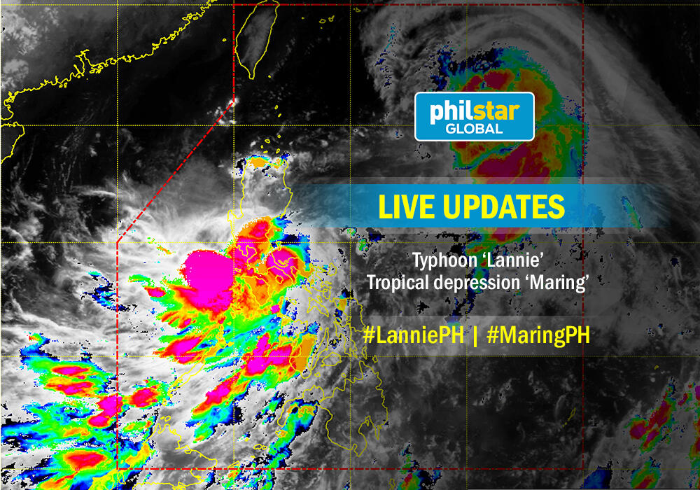
:-Typhoon Lannie or known in the Philippines as Tropical Storm Maring, was a strong typhoon that mostly impacted the Philippines and Vietnamn during mid-September 2017. Forming as the nineteenth named storm of the season,
Is the event possible to happen?
-Yes, because it is natural that our atmosphere to create a typhoon just as this one and take note that we are in Asia which typhoons are commonly formed every year
What are the event’s effect and impact?
The following areas raised signal number 1 excluding Antipolo City :
CatanduanesCamarines NorteCamarines Surnorthern Quezon AuroraQuirinoNueva Ecija
-The typhoon has maximum wind speed of 120km/h and gustiness of up to 145km/h and the Tropical Depression has maximum winds of 45 km/h and gustiness up to 60km/h
Will the event cause damage to the area?
-Yes, even though the typhoon did not affect the country Philippines the typhoon cause a lot of damage outside our country and typhoons can cause a lot of damage and major problems to the country
Can we consider the event a disaster?
-Yes, because the typhoon disrupts a certain area at a certain point of time thus it is a disaster because the effects of the strong winds destroying the surrounding area
KLONKY REYES - TROOP RESEARCHER (Antipolo, City)
klonky
Maayong Buntag!
Welcome to San Jose Del Monte, Bulacan
-Ang Lungsod ng San Jose del Monte (o mas kilala sa tawag na San Jose) ay isang 1st Class na lungsod sa lalawigan ng Bulacan, Pilipinas. Ayon sa 2015 senso, ito ay may populasyon na 574,089 sa may 123,530 na kabahayan. Ang Lungsod ng San Jose del Monte ay pasok sa pang-19 na mataong lungsod sa Pilipinas at ang pinakaunang lungsod sa Lalawigan ng Bulakan, naitatag ito bilang lungsod noong taong 2000. Ang lungsod na ito ay matatagpuan sa hilaga ng Lungsod ng Kalookan at Quezon, timog ng bayan ng Norzagaray, Bulacan, kanluran ng Bayan ng Marilao at Santa Maria, Bulacan at silangan ng Bayan ng Rodriguez, Rizal.
NATURAL DISASTERS
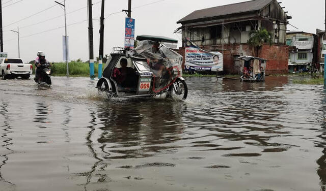
-Bulacan city, 4 towns under a state of calamity due to floods.
-CITY OF MALOLOS, Bulacan -- A city and four towns in Bulacan province have been placed under a state of calamity due to the damages caused by floods brought about by the southwest monsoon or "habagat" in the past few days.
-Mina Ingusan of the Provincial Public Affairs Office (PPAO) said the local governments of Meycauayan City and the towns of Hagonoy, Paombong, Calumpit, and Marilao declared a state of calamity in their respective jurisdictions.
--Ingusan also said the Sangguniang Panlalawigan of Bulacan is pushing for the declaration of a state of calamity for the entire province except for the town of Doña Remedios Trinidad.
-The Provincial Disaster Risk Reduction and Management Office (PDRRMO) reported that as of Tuesday, floods induced by the southwest monsoon rains have caused some PHP41.85 million in initial damage to farms and fishponds in the province.
-A total of 1,096.10 hectares of fishponds in the province were affected by the floods, causing an estimated PHP33,812,517 in losses to 532 fishpond operators.
-Likewise, the PDRRMO said that some 2,280.82 hectares of rice lands were inundated, causing initial estimated damage of PHP8,033,726.78.
-Edgardo Cabigao, barangay chairman of Caliligawan in Malolos, a coastal village along Manila Bay, confirmed that most of the fishponds in the coastal areas of Bulacan had been affected by the floods since Sunday.
“Most if not all of the fishponds in the coastal villages of Masile; Babatnin; Namayan; Pamarawan; and Kaliligawan, all in the City of Malolos, were submerged up to knee-high from its dikes,” Cabigao said.
The latest PDRRMO report showed that the number of villages in the province that went underwater was City of Malolos, 48 barangays; Calumpit, 29; Hagonoy, 20; Bocaue, 16; Paombong, 14; Guiguinto 13; and Marilao with 11 barangays inundated from one-half foot to six feet deep.
Flooded villages in Obando numbered five; Balagtas, five; Baliwag, four; Meycauayan, three; Plaridel, one; and Bustos, one.
--A total of 47 evacuation centers were also established in these flood-affected towns and cities, the PDRRMO said.
-So far, no untoward incident has been reported by the PDRRMO. (PNA)
.What are the event’s effects and impacts?
-A city and four towns in Bulacan province have been placed under a state of calamity due to the damages caused by floods brought about by the southwest monsoon or "habagat" in the past few days.Floods induced by the southwest monsoon rains have caused some PHP41.85 million in initial damage to farms and fishponds in the province. A total of 1,096.10 hectares of fishponds in the province were affected by the floods, causing an estimated PHP33,812,517 in losses to 532 fishpond operators.
-Likewise, the PDRRMO said that some 2,280.82 hectares of rice lands were inundated, causing initial estimated damage of PHP8,033,726.78. The report showed that the number of villages in the province that went underwater was City of Malolos, 48 barangays; Calumpit, 29; Hagonoy, 20; Bocaue, 16; Paombong, 14; Guiguinto 13; and Marilao with 11 barangays inundated from one-half foot to six feet deep.
TYPHOON AMBO (FLOODS)

-TYPHOON “Ambo” forced 13 families from the City of San Jose del Monte and Obando town to evacuate while nine villages in Meycauayan remain submerged in 2 to 3 feet of floodwater on Saturday.
-The Provincial Disaster Risk Reduction and Management Office (PDRRMO) said at the peak of the storm Friday, a total of 13 families from San Jose del Monte and Obando were evacuated to City Disaster Risk Reduction Management Office Evacuation Center, Chapel, and town halls. Power interruptions were also prevalent in the towns of Bocaue, Santa Maria, Baliwag, Doña Remedios Trinidad, Norzagaray, Pulilan, Guiguinto, and Obando, and in the cities of San Jose del Monte and.Meycauayan.Felicisima Mungcal, head of the PDRRMO, said as of the moment, all roads in the province are passable except for Macaiban Bridge in Santa Maria because of clearing and cleaning of the drainage and sewers.
-In Cauayan City, Isabela provincial disaster risk reduction management officer, Retired Brig. Gen. Jimmy Rivera said a resident drowned at the height of the typhoon. Robin Albano Angoluan, 47, died while his brother Roy Albano Angoluan swam safely to the riverbank.
-They were allegedly both drunk and then went fishing at the Cagayan River in Mabantad village at 6 p.m. on May 15. Rivera said four bridges in the province were not passable as of Saturday because of continuous downpour. The submerged bridges were the Annafunan overflow bridge and the Gucab overflow bridge in Echague town, Alicaocao overflow bridge in Cauayan City, and Baculud overflow bridge in the City of Ilagan.
-The rains, on the other hand, were good for Bulacan’s dams that usually supply Metro Manila’s households. As of Saturday, Angat Dam’s water level is 190.19 meters, Ipo Dam is 100.71 meters and Bustos Dam is at 14.75 meters. The water level at the dam reservoir of Magat Dam tapped for irrigation and household water, on May 16 rose 170.93-meter on Saturday from 170.5-meter, an irrigation official said.
-Engineer Carlo Ablan, flood forecasting chief of the National Irrigation Administration-Magat River Integrated Irrigation System, however, told The Manila Times that the collected rains were beneficial but not enough to fill the dam reservoir.
-13 families from the City of San Jose del Monte and Obando town to evacuate while nine villages in Meycauayan remain submerged in 2 to 3 feet of floodwater on Saturday.
The Provincial Disaster Risk Reduction and Management Office (PDRRMO) said at the peak of the storm Friday, a total of 13 families from San Jose del Monte and Obando were evacuated to City Disaster Risk Reduction Management Office Evacuation Center, Chapel, and town halls. Power interruptions were also prevalent in the towns of Bocaue, Santa Maria, Baliwag, Doña Remedios Trinidad, Norzagaray, Pulilan, Guiguinto, and Obando, and in the cities of San Jose del Monte and Meycauayan. Felicisima Mungcal, head of the PDRRMO, said as of the moment, all roads in the province are passable except for Macaiban Bridge in Santa Maria because of clearing and cleaning of the drainage and sewers. The rains, on the other hand, were good for Bulacan’s dams that usually supply Metro Manila’s households. As of Saturday, Angat Dam’s water level is 190.19 meters, Ipo Dam is 100.71 meters and Bustos Dam is at 14.75 meters. The water level at the dam reservoir of Magat Dam tapped for irrigation and household water, on May 16 rose 170.93-meter on Saturday from 170.5-meter, an irrigation official said.
KATE ARENZA- GROUP RESEARCHER (SJDM-Bulacan)
Maya Abak!
Welcome to Marikina
-Ang Lungsod ng Marikina (Ingles: City of Marikina o mas pinaikli bilang Marikina), kilala bilang Sentro o Kabisera ng Sapatos sa Pilipinas, ay isang lungsod at bayan na bumubuo sa Kalakhang Maynila sa Pilipinas. Dati itong punong lalawigan ng Maynila noong ipinahayag ang Kalayaan ng Pilipinas. Matatagpuan ito sa pulo ng Luzon, sa silangang hangganan ng Kalakhang Maynila, napapaligaran ang Marikina ng Lungsod Quezon sa kanluran, Lungsod ng Pasig at Cainta, Rizal sa timog, Lungsod ng Antipolo sa silangan, ang kabisera ng lalawigan ng Rizal, at San Mateo sa hilaga na nasa Rizal din. Tinatayang 21 kilometro ang layo nito mula sa Lungsod ng Maynila.
-Ayon sa 2015 senso, ito ay may populasyon na 450,741 sa may 95,305 na kabahayan.
-Ang Lungsod ng Marikina ay isa sa bumubuo sa Kalakhang Maynila, ang Pambansang Punong Rehiyon sa Pilipinas, at nabibilang ito sa Silangang Distrito ng Kalakhang Maynila. Bahagi rin ito ng Metro Luzon Urban Beltway (Daanang-sinturon ng Mala-lungsod na Kalakhang Luzon). Ang Kalakhang Luzon naman ay binubuo ng Gitnang Luzon, Timog Katagalugan o Calabarzon at ang Kalakhang Maynila. Ang Kalakhang Luzon ay isa sa apat na Malalaking Rehiyon sa Pilipinas.
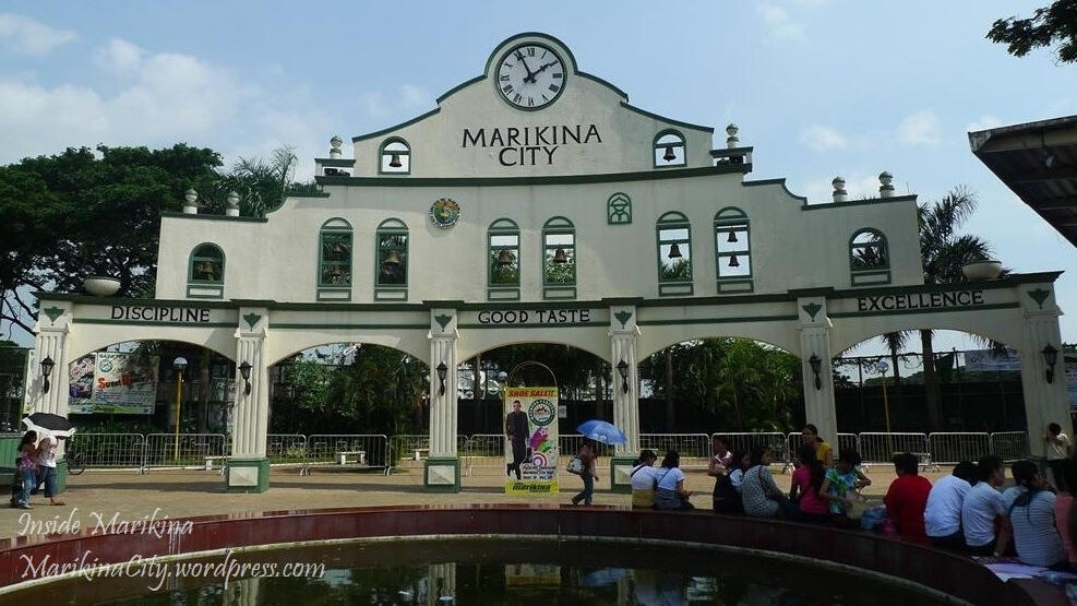
-Tinanyagan ang Marikina bilang "Shoe Capital of the Philippines" o "Pambasang Kapital ng Sapatos ng Pilipinas", dahil sa kanyang sikat na industriya ng sapatos. Ang pinakamalaking pares ng sapatos na ginawa ng mga natatanging sapatero ng lungsod ay naitala sa Guinness Book of Records at makikita sa Riverbanks Mall ng naturang lungsod. Ang Museo ng Sapatos ay kilala din bilang tahanan ng tanyag na sapatos ng dating Unang Ginang Imelda Marcos.
-Dumadaloy ang Ilog Marikina, isang sanga ng Ilog Pasig sa gitna ng lungsod. Sa katunayan, sinasakop ng lungsod ang bahagi ng Lambak ng Marikina at binabaha minsan kapag may mga bagyo (tulad ng nangyari noong Bagyong Ondoy).
NATURAL DISASTERS
TYPHOON ONDOY
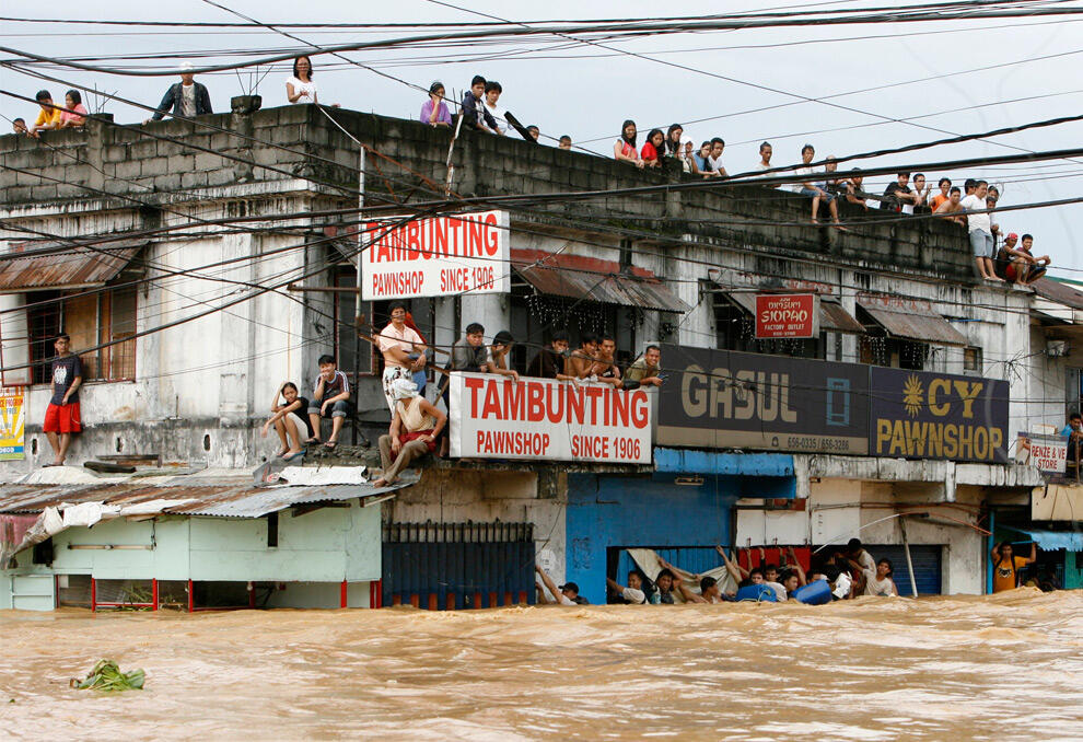
-Typhoon Ketsana, known in the Philippines as Tropical Storm Ondoy, was the second-most devastating tropical cyclone of the 2009 Pacific typhoon season, causing $1.09 billion in damages and 747 fatalities, only behind Morakot earlier in the season. Typhoon #16 (Ondoy) struck southwest Luzon in the Philippines.
-What are the event’s effects and impacts?
Flood disasters caused by this heavy rainfall affected 872,097 people throughout the entire metropolitan area, causing 241 fatalities, 394 injuries, and damaging 65,521 buildings (of which 12,563 were completely destroyed). Infrastructure damages (not including agricultural losses) amounted to 570,187,587 Philippine pesos (NDCC, 2009a). They investigated the great urban flood disaster that occurred in the megacities of the developing country, which are expected to grow to a population of 25 million by 2015. The conditions caused by runoff, flooding, and damages as well as mitigation measures relating to the hydrological conditions, land environments, and social-economic conditions in the Philippines are reported based on field investigations and interviews with related parties.
Will the event affect any population?
The event has affected the estimated of 4 million people in the Philippines. The most affected places were the Metropolitan area or Metro Manila. The government had issued a State of National Calamity in the following areas
LUZON EARTHQAUKE
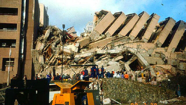
-An earthquake that rattled Luzon lasted for 10 seconds, but skyscrapers in the metropolis swayed for about a minute, the head of the Philippine Institute of Volcanology and Seismology said Tuesday. High-rise buildings in Metro Manila are designed to sway and be flexible, noted Phivolcs chief Renato Solidum. At least 11 people were killed by Monday afternoon's magnitude 6.1 quake, which also flattened some buildings, grounded flights at a secondary airport in Pampanga province, and drove terrified locals into the streets
-What are the event’s effects and impacts?
Pineda will declare a state of calamity in the province on Tuesday due to the massive damage caused by the tremor. For Porac Mayor Condralito Dela Cruz, the ground moved like waves when he felt the earthquake. "It was the strongest earthquake we've had. It was no joke," he told ABS-CBN News. "That's why we are shocked it (supermarket) gave way because it was still new." Public Works Secretary Mark Villar said Central Luzon sustained heavy damage from the tremor, which centered in Castillejos, Zambales. These include the Clark International Airport, bridges, and old churches in Pampanga and Bataan and the Dinalupihan-Pampanga Boundary Arc. As of 8:30 p.m., some 102 people were reported injured while 31 remain missing in the region. Thousands of travelers were also stranded after aviation authorities shut down the Clark International Airport. The Philippines is part of the Pacific "Ring of Fire", an arc of intense seismic activity that stretches from quake-prone Japan through Southeast Asia and across the Pacific basin.
Will the event affect any population?
The areas that were most affected are:
Central LuzonMetro ManilaCALABARZON
MARIKINA'S MINI TORNADO

-A newlywed couple's big day went from a dream moment to a nightmare, as a rare tornado crashed their party in Marikina on Friday afternoon. The groom and the bride can be seen celebrating the occasion with guests at Kapitan Moy until a crackle stopped the festivities and an ensuing blackout sent everyone in the room panicking. A twister with a 1-kilometer radius affected about 20 houses in barangays San Roque and Santa Elena in Marikina.
-According to Marikina Mayor Marcy Teodoro, among those damaged by the tornado is the -Marikina Cultural Center, an 800-square meter adobe structure, which saw the entire roof stripped off. Authorities are now assessing the extent of damage on site.
Will the event affect any population?
In Marikina City, the most affected areas are:The old house where the bride and groom where celebratingBarangay San Roque Barangay Santa Elena The 100- year old Cyntheneal Tree
JM TICSAY- ORGANIZATION RESEARCHER (Marikina)
Maayo na Adlaw!
Welcome to the Province of Rizal
Ang Rizal ay isang lalawigan sa gitnang bahagi ng isla ng Luzon sa Pilipinas. Pinapaligiran ito ng Kalakhang Maynila sa kanluran, sa hilaga ang Bulacan, sa silangan ang lalawigan ng Quezon, at Laguna sa timog. Pinangalan ang lalawigan na ito sa pambansang bayani ng Pilipinas na si Gat. Jose Rizal.
Magarang Araw!
Welcome to Teresa
-Teresa, officially the Municipality of Teresa (Tagalog: Bayan ng Teresa), is a 2nd class municipality in the province of Rizal, Philippines. According to the 2015 census, it has a population of 57,755 people.
-It is situated in the slopes of the Sierra Madre Mountains and is landlocked on four corners by Antipolo on the north, Angono on the west, Tanay, on the east, and Morong, on the south.
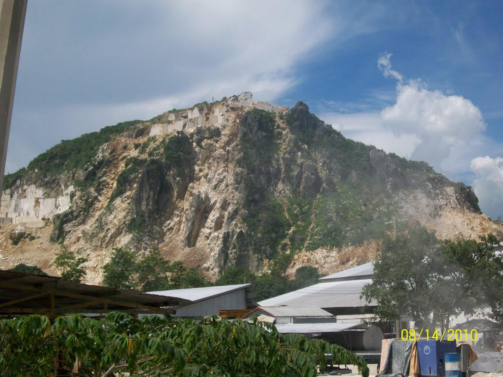
-Most of the people here are Tagalogs. Teresa is primarily known for the nearby mountain resorts, Villa Sampaguita Resort and Real Cove Resort (Formerly Sunrise Resort, Sunset Resort, and Terra Villa Resort). Contrary to some articles, Teresa is actually a valley surrounded by mountains. The town center is located almost at the center of the valley. In an aerial view of Teresa, one would notice the previously vast expanse of agricultural land bordered by marble-rich mountains.
-The town is passed by motorists bounded for the more inland towns of Morong, Baras, Tanay, Pililla, and Laguna and Quezon provinces.
-Land uses (in hectares): Commercial (1.92), Residential (104.32), Agricultural (1183.35), Protected areas (13,952.41), Industrial / Ecozone (710.69), Institutional (112.28), and Special / Other uses (123.03).
-The town's festivals are the Turumba sa Mahal na Patron Santa Rosa (held every August 23), the Anniversary celebration of town independence (every December 30), and Town fiesta (every 1st Sunday of March)
NATURAL DISASTERS
TYPHOON SENDONG

-Tropical Storm (TS) Sendong (International name: Washi) was the second tropical storm that affected Mindanao in 2011 and the 19th tropical cyclone that entered the Philippine Area of Responsibility (PAR) in the same year. Typhoon Sendong poured a usual amount of rainfall for tropical storms that hit the Philippines but unusual to those that hit Northern Mindanao. The Lumbia PAGASA Station recorded a one-day rainfall of 180.9 mm which is higher than the monthly average of 117 mm during December in the period 1977-2005. The declaration of a National State of -Calamity was made by President Benigno C. Aquino, III, on December 20, 2011, through Proclamation No. 303.
-Cagayan de Oro City, Iligan City, and the rest of the affected areas are all located in an area with complex river systems related to six major watersheds.
With the rapid and unplanned urbanization of these cities and the location of residential settlements in hazard-prone areas, people and communities became vulnerable.
-As of 10 February 2012, figures for all affected regions showed that a total of 1,268 fatalities were claimed by the disaster, with 6,071 injured and 181 reported as missing. Among the regions affected by TS Sendong, Region X has the highest number of casualties with 1, 206 dead, 6,036 injured, and 162 missing.
-In December 2011, the world's second most deadly disaster of the year, Tropical Storm Washi (known as Sendong in the Philippines) landed along the east coast of Mindanao, Philippines, causing 1,292 deaths, 1,049 missing, 2,002 injured, and total 695,195 people (110,806 families) affected. This paper introduced briefly the hydro-meteorological characteristics of Washi and assessed its devastating impacts on society and the economy, and the response and recovery taken by the Philippines government during the whole period of Washi. Based on the assessment of the impact of the disaster, the paper indicated the gaps and needs on aspects of DRR actions and identified the future challenges on typhoon related disaster preparedness and reduction in the Philippines. Finally, the report provided recommendations within the framework of the activities of the Typhoon Committee to improve and enhance the capacity building on typhoon related disaster reduction in the Philippines.
-What are the event’s effects and impacts?
The NDRRMC in the Philippines publishes remarkably detailed reports on the impacts of natural disasters, and the efforts to manage their aftermath. This is the best place to get realistic figures on the impact of the disaster. In terms of the number of missing people at the time of writing, this is somewhat lower than some international agencies are reporting. The statistics are however shocking – 632 killed, 16 injured and 82 people reported missing, 6917 houses damaged. At the end of the report they list the names of the victims, but what is quite worrying here is the number of unidentified bodies – for example in Lanao del Norte 227 bodies are unidentified.
Unsurprisingly, the inquest into why this event had such a large impact has already started, with “a freak storm, poor warning systems, flimsy buildings and human folly” all being blamed. All of these may well be true – it would be interesting to see some detailed aerial imagery of the areas affected and some details about the rainfall. However, two things should be kept in mind here. The first is that this storm is really unseasonal for the Philippines – the map below shows the tracks for all of the tropical cyclones in the Western Pacific in December from 1978 to 2010 (data and map from Digital Typhoon):
There are only 15 events in December in the entirety of this period, and only two of these made landfall. Thus, the event in itself was quite unusual. A further complicating factor may well have been that the worst of the rainfall, and hence the floods, seems to have been at night when people are more vulnerable.
The second is that once again this highlights that our classification of tropical cyclones is not fit for purpose, as I have previously noted. The current classification of tropical cyclones is undertaken on the basis of wind parameters, but most of the damage is done by water (floods, storm surges, and landslides). So all I can do is repeat my observation made earlier this year:
“So, there seems to me to be an urgent need to do two things. The first is to improve understanding of the range of impacts associated with tropical cyclones, and in particular with respect to rainfall-induced disasters. Second, it really is time that we improved the Saffir-Simpson scale to encompass more than wind speed, such that the potential impacts of an impending tropical cyclone can be properly assessed. This is clearly not a trivial task, but it would seem to be an urgent research need.”
Proper classification and forecasting of this hazard is an essential first step towards reducing the consequences associated with it.
-Will the event affect any population?
In December, 2011, the world's second most deadly disaster of the year, Tropical Storm Washi (known as Sendong in the Philippines) landed along the east coast of Mindanao, Philippines, causing 1,292 deaths, 1,049 missing, 2,002 injured, and total 695,195 people (110,806 families) affected.
-Will the event cause any damage to the area?
Yes, As a whole, the total estimated damage for all sectors amount to PHP 12,086,284,028 and the total estimated losses to the economy reach PHP 1,239,837,773.32. Overall, the recovery and reconstruction needs amount to PHP 26,226,715,100 Housing. Total damage of PhP 1,924,813,928 was estimated based on 28,032 totally destroyed houses and 11,439 partially damaged homes in the four affected areas, including damage to household goods. Loss estimates amount to PHP 162,329,785, which accounts only for the cost of transitional housing and shelter repair kits distributed to affected households. The estimated total damage and losses in the housing sector are PHP 3,124,579,713.
-Can we consider the event as a disaster?
We can say that this typhoon sendong is a disaster because in Cagayan de Oro City, Philippines Living on the edge of riverbanks, families displaced by Sendong (international name: Washi) a few days ago had once fled their homes in 2009 at the height of a storm. With no alternative relocation then, they had gone right back, holding on to their proximity to the city and the assurance of livelihood.
TYPHOON BEBENG
-Tropical Storm Aere, known in the Philippines as Tropical Storm Bebeng, was a mild tropical storm that affected eastern Philippines and southern Japan. It was the first named storm of the 2011 Pacific typhoon season. Aere is the Marshallese word for storm.
-In the Philippines, Aere brought very heavy rainfall triggering landslides and floods knocking out power in several areas across Luzon. More than 50 flights were canceled or diverted because of the bad weather conditions and President Benigno Aquino III delayed his flight home from a summit in Indonesia by a day. The coastguards have stopped smaller boats from leaving ports in Catanduanes and surrounding areas, leaving 1,379 people stranded. More than 7,200 hectares (17,800 acres - 27 square miles) of rice, corn, and high-value crops costing more than 118 million pesos ($2.7 million) were destroyed or damaged. At least 35 people have been killed and two more are missing as a result of Aere. Agricultural losses are estimated at PHP1.37 billion (US$31.7 million).
-As preparation for this typhoon after PAGASA started monitoring the system, the NDRRMC raised storm warning signal 1 over the areas of Luzon and Visayas. The Philippine National Police were directed to continuously report the events to the NDRRMC as it happened. The Department of Health also alerted all the hospitals in the storm-prone regions and asked them to sit in continuous coordination with PAGASA. Soon, the PDRRMC initiated evacuations across the Albay province with a population of 63,964 residing in 152 Barangays already evacuated as a pre-emptive measure. Also, the Armed Forces of the Philippines (AFP) deployed several assault vehicles and military personnel to closely monitor the situation across the nation and to haul rice for relief operations.
-What are the event’s effects and impacts?
Early on 8 May, Aere made landfall over Northern Catanduanes bringing very heavy rainfall across the nation. Around 210 passengers in the port of Lucena bound for Marinduque and 125 passengers in the port of Romblon bound for San Fernando, Romblon were stranded after their ships were cancelled due to heavy rains and rough sea conditions caused by the storm. More than 100,000 villagers fled from towns threatened by landslides. Aere triggered landslides and floods knocking out power in several areas across Luzon. Thousands were helped to flee from their farms around Mayon volcano in Albay province, which was threatened by landslides and heavy rains that have resulted in extensive flooding after the storm. A resident in Sorsogon province who was one of the victims expressed views on the storm, saying "The floods were so deep, they went past the head". More than 50 flights were canceled or diverted because of the bad weather conditions caused by Aere. President Benigno Aquino III delayed his flight home from a summit in Indonesia by a day due to the bad weather. The Disaster officials advised several villagers in the archipelago's agricultural regions situated in the north to stay prepared for landslides and flash floods after heavy rains poured by the storm. The coastguards have stopped smaller boats from leaving ports in Catanduanes and surrounding areas, leaving 1,379 people stranded after the NDRRMC's announcement that the security at coasts must be tightened.More than 7,200 hectares (17,800 acres - 27 square miles) of rice, corn and high-value crops costing more than 118 million pesos ($2.7 million) were destroyed or damaged. According to the National Disaster Risk Reduction and Management Council, at least 35 people have been killed and two more are missing as a result of Aere. Agricultural losses are estimated at PHP1.37 billion (US$31.7 million). Widespread flooding and landslides damaged homes, blocked off roads and severed communications. In Catarman, Northern Samar, 377.4 mm (14.86 in) of rain fell in just 24 hours, resulted in significant flash flooding.
-Will the event affect any population?
At least 35 people have been killed and two more are missing as a result of Aere. Agricultural losses are estimated at PHP1.37 billion (US$31.7 million).
TYPHOON REMING
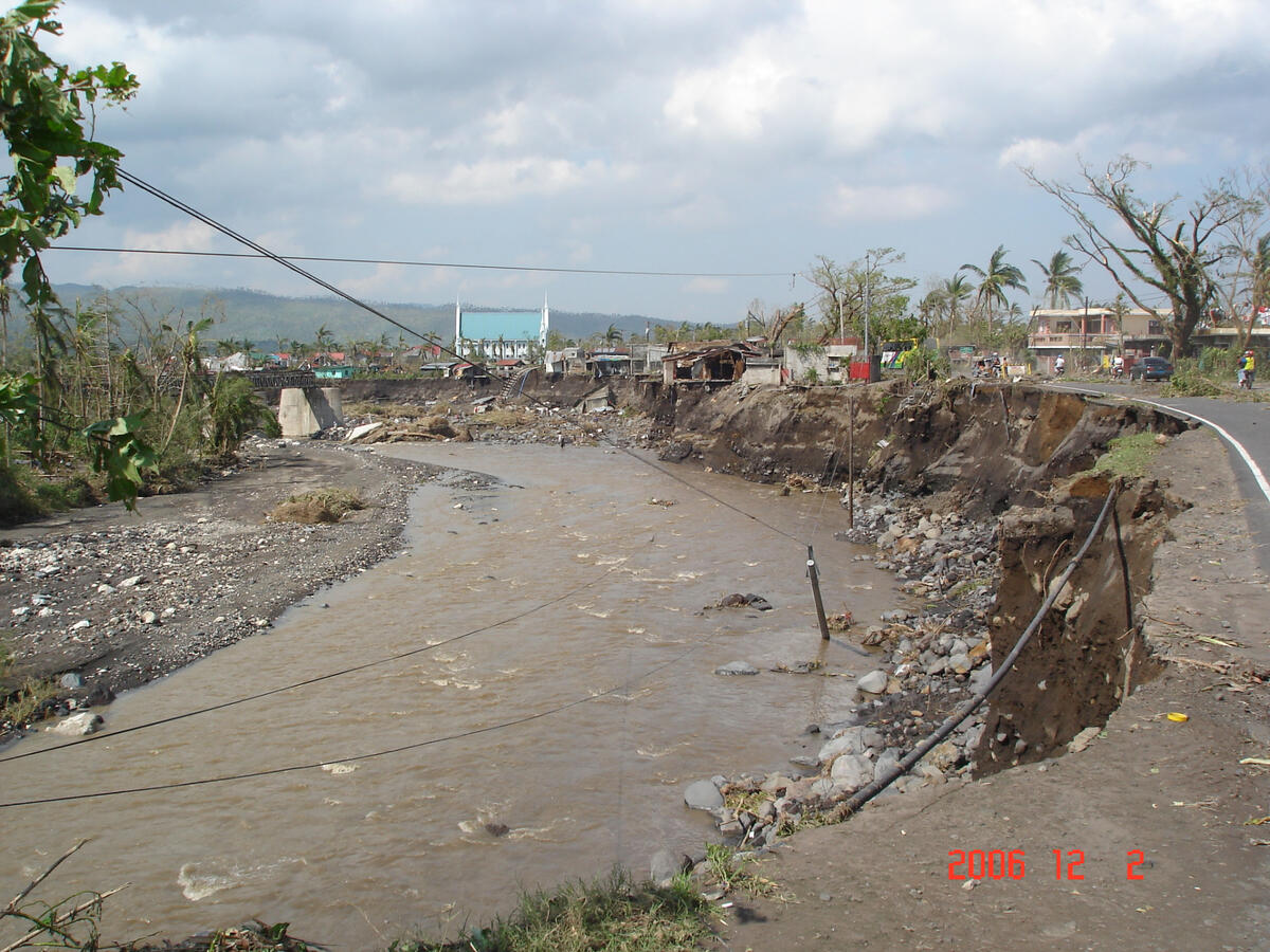
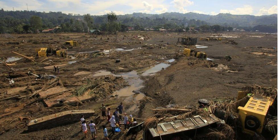
-Typhoon Durian, known in the Philippines as Typhoon Reming, caused heavy damage across the island nation in November 2006. On November 30, 2006, Durian became the fourth typhoon equivalent to a Category 4 on the Saffir-Simpson scale to strike the Philippine island of Luzon, having earlier brushed the offshore Catanduanes. The storm crossed the country, but the damage was heaviest in southeastern Luzon, particularly around the Mayon Volcano in the Bicol region. Intense rainfall affecting the volcano, estimated at around 600 mm (24 in), caused deadly lahars, or volcanic landslides. Six nearby villages were nearly destroyed, with thousands of homes washed away in minutes.
-The northwestern Pacific Ocean is the most active tropical cyclone basin in the world, with a 50-year average of 26 tropical storms developing across the region in a given year. The Bicol region, where Durian first struck, is located at the southeastern portion of the Philippine island of Luzon and is affected by an average of 8.4 tropical cyclones per year.
-Typhoon Durian formed as a tropical depression on November 24 near Chuuk State and moved generally west-northwest, becoming a tropical storm two days later] Favorable environmental conditions enabled the system to rapidly intensify on its approach to the Philippines. On November 28, Durian entered the area of responsibility of PAGASA – the Philippines' weather bureau – who gave the local name Reming to the storm. Durian reached its peak strength with ten-minute sustained winds of 195 km/h (120 mph) and a barometric pressure of 915 bar (hPa; 27.02 inHg) on November 29 before striking the Philippines, striking northern Catanduanes and later Camarines Sur in southeastern Luzon. Durian was the fourth typhoon equivalent to a Category 4 on the Saffir-Simpson scale to strike the island of Luzon in 2006. Continuing westward, Durian weakened over the archipelago and struck northern Mindoro on December 1. That day, Durian emerged into the South China Sea as a minimal typhoon. On December 5, the storm struck Vietnam south of Ho Chi Minh City. Durian quickly weakened to a tropical depression thereafter and continued westward over the Gulf of Thailand, and eventually dissipated over the Bay of Bengal.
-What are the event’s effects and impacts?
Typhoon Durian affected about 3.5 million people in the Philippines, of whom about 120,000 were left homeless. Durian damaged 588,037 houses, including 228,436 that were destroyed, many of which were made out of wood. Across the country, the storm wrecked 5,685 schools, estimated at US$63.5 million in damage. The Bicol Region accounted for 79% of the damaged schools, affecting around 357,400 children. The damage was estimated at ₱5.45 billion (PHP, US$110 million). As of December 27, 2006, the death toll stood at 734, with 762 missings. The International Disaster Database listed 1,399 deaths in the Philippines related to Durian, making it the second deadliest natural disaster in 2006 after an earthquake in Indonesia.While crossing the Philippines, Durian dropped 466 mm (18.3 in) of rainfall at Legazpi, Albay in 24 hours, including an hourly total of 135 mm (5.3 in). The 24 hour total was the highest in 40 years for a station in the Bicol region. Gusts were estimated as high as 260 km/h (160 mph).The worst of the storm effects were in Albay, Camarines Sur, Catanduanes, Mindoro, and Quezon. The storm damaged coconut plantations, with all of the trees in Bacagay wrecked, affecting the livelihood of half of the residents. Overall, about 30,000 ha (74,000 acres) of rice fields were destroyed, accounting for 65,481 metric tons of corn; 19,420 metric tons of rice were also damaged. However, the crops were already harvested, so the storm's agriculture effects were minor. The storm also wrecked 1,200 fishing boats, severely affecting the local fishing industry, and killed much livestock.Heavy rainfall caused rivers and irrigation canals to exceed their banks. Many creeks and small streams were flooded in the Bicol region.
-Will the event affect any population?
Typhoon Durian affected about 3.5 million people in the Philippines, of whom about 120,000 were left homeless. As of December 05, 2006, the death toll in the Philippine Islands from Typhoon Durian (called Typhoon Reming in the Philippines) now stands at 1226 dead or missing, according to Philippine disaster officials, and is certain to go higher as rescue workers continue to recover bodies from mudslides that buried at least eight villages at the foot of Mayon Volcano.
-Will the event cause any damage to the area?
The eye of Durian passed near Mayon Volcano as it struck the Bicol region. In the mountainous region, a process known as orographic lift produced heavier rainfall than near the coast, with totals possibly as high as 600 mm (24 in).
LOANNE RUALLO - TROOP RESEARCHER (Teresa, Rizal)
Magandang Araw!
Welcome to Cainta

-Cainta is bounded on the north by Marikina City and Antipolo but not bounded San Mateo, on the west by Pasig City, and on the east and south by Taytay. It lies in the Marikina Valley, which is 10% rolling hills and 90% residential-industrial. It has the province's highest number of rivers and streams. There are 311,845 people living in Cainta.
NATURAL DISASTERS
ASHFALL

-An ashfall is possible to happen because when Taal volcano erupted ( which is located in Batangas) some parts of Rizal experienced ash falls (including my hometown Cainta, Rizal) The ashes from the ashfall are dangerous for our health it may have short-term effects commonly include irritation of the eyes and upper airways and exacerbation of pre-existing respiratory disease such as asthma; serious health problems are rare. This affected Cainta, Rizal, because people were not allowed to go outside without a mask. Of course, I would consider this as a disaster because it has affected many people.
DISEASE OUTBREAK

-This disaster is happening in the world right now. This made the way of our life changed, it changed by making it harder. It completely changed our lifestyle. Schools are now online, Even some works are being accomplished in our homes. This has affected people because some died and some lost their loved ones. I consider this as a disaster because the Covid-19 outbreak is already considered as a pandemic
ANDREI LAMA- TROOP RESEARCHER (Cainta, Rizal)
Maayong Aldaw!
Welcome to Bicol Region

-Ang Bicol (binabaybay ding Bikol; tinatawag ding Kabikulan at Rehiyon 5) ay isa sa 17 mga rehiyon ng Pilipinas. Binubuo ang Bicol ng limang lalawigan sa Tangway ng Bikol, ang pinakatimog-silangang bahagi ng pulo ng Luzon, at ng dalawang pulong lalawigan malapit sa tangway. Ang Lungsod ng Legazpi † ang kabisera, sentro ng pulitika at administrasyon ng rehiyon, samantalang ang Lungsod ng Naga naman ang sentro ng relihiyon, edukasyon, ekonomiya, industriya at ekonomiya sa rehiyon.
-Matatagpuan ang Kabikulan sa pinakatimog na dulo ng Luzon, ang pinakamalaking pulo sa kapuluan ng Pilipinas. Ang kabuuang sukat ng lupa ng rehiyon ay nasa 18,054.3 km2 (6,970.8 mi kuw),[8] na 5.9% ng kabuuang sukat ng lupa ng buong bansa. Nasa 69.3% ng kabuuang lupa ay maaaring tirahan samantalang ang nalalabing 30.7% ay binubuo ng mga kagubatan.
-Naghahanggan ang rehiyon sa Look ng Lamon sa hilaga, sa Dagat Pasipiko sa silangan, sa Dagat Sibuyan at Golpo ng Lagay sa kanluran. Ang pinakahilagang lalawigan ng rehiyon, ang Camarines Norte, ay naghahanggan sa hilaga sa lalawigan ng Quezon, na nag-uugnay sa rehiyon sa ibang bahagi ng Luzon.
-Ang mga lalawigan na bumubuo sa rehiyon ay ang mga sumusunod:
Albay (Legazpi, Ligao, Tabaco, Bacacay, Camalig, Daraga, Guinobatan, Jovellar, Libon, Malilipot, Malinao, Manito, Oas, Pio Duran, Polangui, Rapu-Rapu, Santo Domingo, Tiwi)Camarines Norte (Busud, Capalonga, Daet, Jose Panganiban, Labo, Mercedes, Paracale, San Lorenzo Ruiz, San Vicente, Santa Elena, Talisay, Vinzons)Camarines Sur (Baao, Balatan, Bato, Bombon, Buhi, Bula, Cabusao, Calabanga, Camaligan, Canaman, Caramoan, Del Gallego, Gainza, Garchitorena, Goa, Lagonoy, Libmanan, Lupi, Magarao, Milaor, Minalabac, Nabua, Naga, Ocampo, Pamplona, Pasacao, Pili, Presentacion (Parubcan), Ragay, Sagñay, San Fernando, San Jose, Sipocot, Siruma, Tigaon, Tinambac)Catanduanes (Bagamanoc, Baras, Bato, Caramoan, Gigmoto, Pandan, Panganiban (Payo). San, Andres (Calolbon), San Miguel, Viga, Virac)Masbate (Aroroy, Baleno, Balud, Batuan, Cataingan, Cawayan, Claveria, Dimasalang, Esperanza, Mandaon, Masbate city, Milagros, Mobo, Monreal, Palanas, Pio V. Corpuz, Placer, San Fernando, San Jacinto, San Pascual, Uson)Sorsogon (Barcelona, Bulan, Bulusan, Casiguran, Castilla, Donsol, Gubat, Irosin, Juban, Magallanes, Matnog, Pilar, Prieto Diaz, San Magdalena, Sorsogon city)
-Ang Rehiyon V ay isang tangway. Makikita sa mapa na halos napapalibutan ito ng tubig. Dahil dito, ang mga pamayanang malapit sa tubig ay umaasa nang malaki sa pangingisda.
-May mga yamang mineral din ang rehiyong ito. Ang paracale sa Camarines Norte ay pangunahing tagapagmina ng ginto at tanso. Minimina rin sa ibang bahagi ng rehiyon ang marmol, pilak, bakal, karbon, chromite, manganese at abaka. Mayaman din ito sa mga magagandang tanawin tulad ng Bulkang Mayon ng Albay.